Data & Tools
SCAG has a wide range of data and tools to help you access regional planning data, statistical data and research information.
The SCAG Data Services Program started in the late 1980s with the goal of providing the preeminent source of information for Southern California. The program models an accessible and effective policy for distributing geospatial data and other information. We believe strongly in providing data services to stakeholders that we have incorporated this philosophy into the SCAG Strategic Plan.
The SCAG GIS Services Program started in the late 1980s to create the preeminent source of information for the Southern California region. The purpose of the program is to derive and promote a model policy for distributing geospatial data and other information developed and maintained at SCAG.
program goals
- Make geographic information and data more accessible.
- Partner with local governments and public agencies on data standardization.
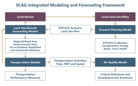
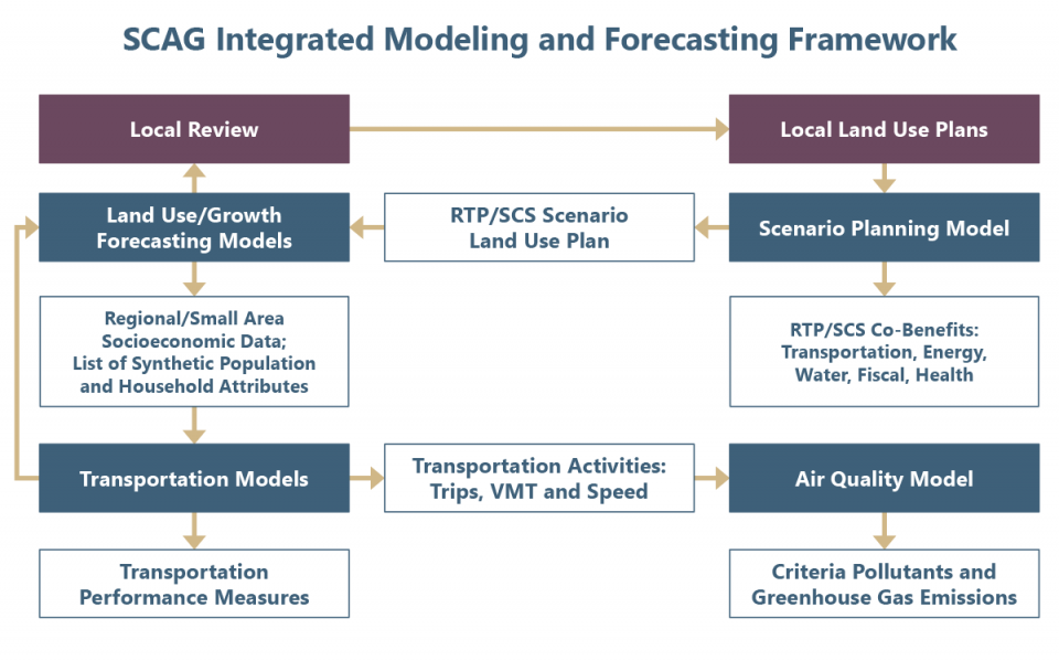
SCAG utilizes an integrated analytical framework to develop growth projections, travel forecasts, and emissions estimates to support the region’s various planning programs.
The primary functions of SCAG’s Modeling and Forecasting Department include:
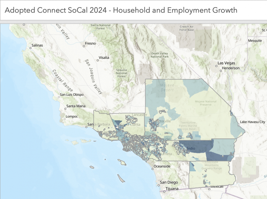
Connect SoCal 2024
As a performance-based plan, the investments identified in the Connect SoCal 2024 Regional Transportation Plan/Sustainable Communities Strategy are expected to result in significant benefits to the region, not only with respect to transportation and mobility, but also air quality, economic activity, job creation, sustainability, public health and equity.
Every four years, SCAG develops a three-decade projection of population, household, and employment growth at the region, county, jurisdiction, and transportation analysis zone levels for the Connect SoCal Regional Transportation Plan, Sustainable Communities Strategy. Unlike a short-term projection, which depends heavily on economic cycles, long-term regional growth is driven by births, deaths, migration, and the composition of the region’s industries relative to the rest of the country. To begin the growth forecast process, SCAG convenes a panel of demographic experts. Local jurisdictions also provide, review, and integrate project-level information through the Local Data Exchange process.
Demographic profile summary reports for each of the 197 cities in the SCAG region and the unincorporated areas in each of the six counties based on data provided through the SCAG SoCal Atlas tool. The most recent SoCal Atlas Jurisdictional reports are available for download below.
Contact
For additional information, please contact:
Mike Gainor
Senior Regional Planner
(213) 236-1822
gainor@scag.ca.gov